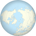
File:Worldmap northern.svg
Appearance

Size of this PNG preview of this SVG file: 553 × 553 pixels. Other resolutions: 240 × 240 pixels | 480 × 480 pixels | 768 × 768 pixels | 1,024 × 1,024 pixels | 2,048 × 2,048 pixels.
Original file (SVG file, nominally 553 × 553 pixels, file size: 589 KB)
File history
Click on a date/time to view the file as it appeared at that time.
| Date/Time | Thumbnail | Dimensions | User | Comment | |
|---|---|---|---|---|---|
| current | 12:34, 1 Me 2013 |  | 553 × 553 (589 KB) | Gringer | updated script -- proper group ordering |
| 01:03, 29 Aperila 2013 |  | 552 × 552 (465 KB) | Gringer | Updated perlshaper script | |
| 10:31, 3 Setema 2010 |  | 550 × 550 (563 KB) | Gringer | Updated using [http://www.naturalearthdata.com Natural Earth Data]. | |
| 01:17, 13 Fepuari 2009 |  | 181 × 181 (308 KB) | Gringer | increase in ocean size to make border sit mostly outside land | |
| 01:10, 13 Fepuari 2009 |  | 180 × 180 (308 KB) | Gringer | {{Information |Description={{en|1=A polar projection of the northern hemisphere from Image:Worldmap_wdb_combined.svg. Created from [http://www.evl.uic.edu/pape/data/WDB/ CIA World Databank data] using an updated version of my [http://user.interface.o |
File usage
There are no pages that use this file.
Global file usage
The following other wikis use this file:
- Usage on en.wikipedia.org
- Usage on pl.wikipedia.org
- Usage on pl.wikinews.org
- Usage on sl.wikipedia.org
